The Map Contents panel is a central component of the ArcGIS Map Web Part. As you might expect, the Map Contents panel displays the list of layers contained in the map, and you can use it to toggle layer visibility on and off. But beyond that, it determines the web part's selected layer. For more information on the components of the of the ArcGIS Map Web Part, see The ArcGIS Map Web Part.
The Map Contents panel displays all the layers that have been added to the map:
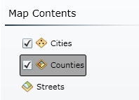
In the image above, notice that the Cities layer is highlighted. This indicates that it is the selected layer. The selected layer determines the context for the controls on the Layer and Symbols tabs, as well as the attributes in the attribute table. Put another way, with the Cities layer selected, any controls on the Layer tab or the Symbols tab - such as the Rename button or the Transparency slider - will operate on the Cities layer, and the attribute table will show tabular data from that layer as well. To select a different layer, simply click on its name.
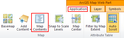
To show the Map Contents panel, simply click the Map Contents button on the Map tab of the web part's ribbon: