The ArcGIS Spatial Data Service (SDS) provides a REST endpoint that exposes the contents of a SQL Server instance over the web. Tables that include spatial data can be added as layers to the ArcGIS Map Web Part through the Browse Panel.
|
When content is added while the Map Web Part is in edit mode, it will be persisted. When the Map Web Part is not in edit mode, content can be added for the current session only. |
You can add SDS content to the map as follows:
-
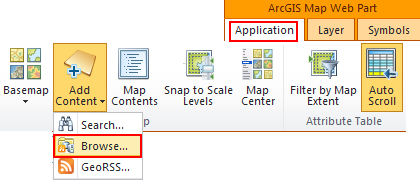
To open the Browse panel, click the Add Content button on the Map tab, then select Browse from the menu that appears:
-
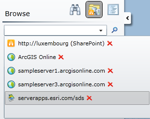
To select a data source to browse, expand the drop-down and select the SDS endpoint of your choice. SDS endpoints are shown with a icon that shows a map and arrow. Note that no SDS endpoints are included in the drop-down by default:

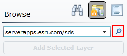
The data sources that appear by default in the drop-down can be modified by editing the ArcGIS Mapping Connections list. Alternatively, you can type the URL to an ArcGIS Server endpoint and click the Browse button next to the drop-down:

All or part of the SDS endpoint URL can be specified. The full REST endpoint URL must be in the format <scheme>://<host>:<port>/<instance>/databases. The host must always be specified, but the other parts of the URL will be filled in automatically with default values if they are not specified. A description of each part as well as the default value for each is provided in the table below:
Parameter Description Default Value scheme
The protocol of the URL - http or https http host The domain (e.g. serverapps.esri.com) or machine name (e.g. serverapps) N/A port The TCP port over which the site or REST endpoint is available. If the scheme is http and the port is 80 or the scheme is https and the port is 443, the port does not need to be specified as part of the URL 80 if scheme is http, 443 if scheme is https instance The name of the Spatial Data Service instance sds -
Once an ArcGIS Server endpoint is connected to, the services and folders provided by that endpoint are displayed in the panel:
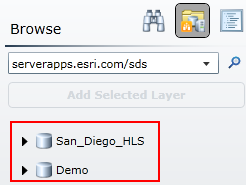
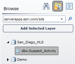
To add a table to the map, expand a database node, select the desired table, and click Add Selected Layer:
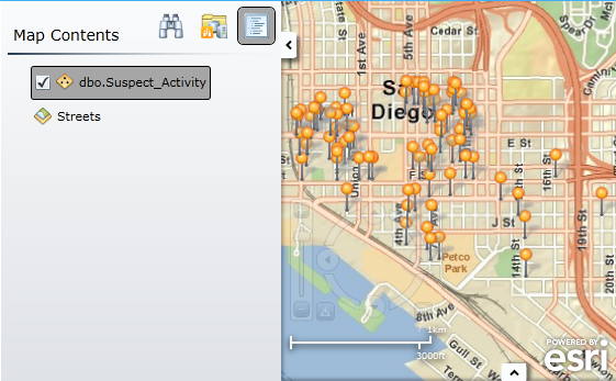
Once the table has been added, it will be displayed in the Map Contents panel and will be added to the map:
Configuring ArcGIS Mapping
Configuring Connections


