Configure Data
Once a dataset has been added to the map, you can configure a set of properties to refine and enhance the look, feel, and functionality of the layer. The following properties can be configured in the Properties dialog by selecting the appropriate tab and changing the corresponding setting. Click on a section title below for additional information on the properties listed:
 Definitions
- Display name
- Filter expression
- Transparency
- Check for Updates
- Pop-Ups
- Show\hide fields
- Field aliases
- Symbols
- Marker icons
- Line styles
- Area fill and border style
- Single versus value range renderers
- Value range class breaks, symbols, and colors
- Transparency
- Location Fields
- Address field mapping
- Coordinate field mapping
- Locator service
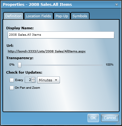
The Properties dialog in the Map Web Part provides a separate tab to manage each section: Definition, Pop-ups, Symbols, and Location Fields.
Note: The tabs that are visible vary depending on the type of data being configured. The Location Fields tab is only visible when configuring SharePoint lists. When configuring ArcGIS Server map service layers, only the Definition tab is visible.
