| Publishing a map | |
| Publishing a map | |

After you have created a map configuration file, you are ready to create an ArcIMS service. You need to have one or more services running before you can Create a Web application. You can publish services one of three ways: using ArcIMS Administrator, Service Administrator, or command line administration.
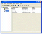 |
ArcIMS Administrator. ArcIMS Administrator is a standalone application. For more details about Administrator, the best starting point is Starting ArcIMS Administrator and Service Administrator.
While Administrator is the most widely used of the administration options, one limitation is you cannot administer multiple ArcIMS Application Servers. Should this need arise, you will need to use the Service Administrator. |
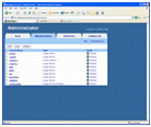 |
Service Administrator. Service Administrator is a Web application. Since it is a Web application, you can easily administer an ArcIMS site remotely. You can also administer ArcSDE services and multiple ArcIMS Application Servers. For more information, see Starting ArcIMS Administrator and Service Administrator. |
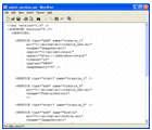 |
Command line administration. ArcIMS services can be managed from the command line, and you can do most of the tasks you do in Administrator. One of the advantages of the command line is it allows you to automate processes such as starting, stopping, and refreshing services. More details about command line administration are available in Administering an ArcIMS site from the command line. |
When you publish a service, you must select which service is best for you based on your anticipated needs. ArcIMS has the following options:
| Service type | Description |
|---|---|
| 1. Image Service | An Image Service delivers map content to a client application as JPEG, PNG, and GIF images. A new map image is generated each time a client requests new information. Clients that use Image Services include the Web Mapping Application, the HTML Viewer, Java Custom and Standard Viewers, ArcMap, and ArcPad among others.
The input to an Image Service is a map configuration file you create in Author. Use an Image Service when:
|
| 2. Feature Service | A Feature Service is a service that delivers map content to the user as streamed features. Feature streaming is a temporary compressed format that remains only as long as the client is open. Requests are sent to the Spatial Server only when additional data is needed. Clients that can read this stream include the Java Standard and Custom Viewers, ArcExplorer-Java Edition, and ArcMap.
The input to an Feature Service is a map configuration file you create in Author. Use a Feature Service when:
|
4. Metadata Service | A Metadata Service lets you and your users share metadata - information about a data set. Metadata for geographic data typically describes the content, quality, type, collection date, and spatial location of the actual data. Looking at metadata can help your users determine whether a particular data set is appropriate for their needs.
The input to a Metadata Service is a configuration file specific to metadata needs. For more information on this file, see Creating Metadata Services. |
Once you have created an Image or Feature Service, you can create metadata that describes the service using ArcCatalog. You do not need a Metadata Service to do this; the functionality is available by default with ArcIMS. For more information, see Adding Metadata to an ArcIMS Service.