When an address is geocoded, multiple possible locations may be found for the address. These possible locations are known as address match candidates. When multiple candidates are found, ArcGIS Mapping for SharePoint attempts to select the best one automatically. In most cases, this is sufficient. However, there are times when a geocoding operation results in multiple candidates of similar quality, and the auto-selected candidate is not in fact the best one. For this reason, the ArcGIS Location Field stores the set of address match candidates returned by a geocoding operation and allows you to manually select a candidate. Selecting an address match candidate can be a SharePoint task created as a result of executing an ArcGIS Geocoding Workflow, or it can simply be an action taken to ensure the appropriate address candidate for the Location field was selected during the geocoding process.
-
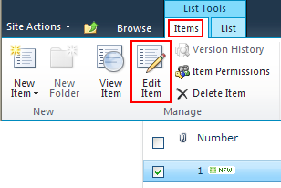
Selecting an address match candidate for an item requires editing the item. From a SharePoint list, select an item that has been geocoded, then click the Edit Item button on the Items tab:

-
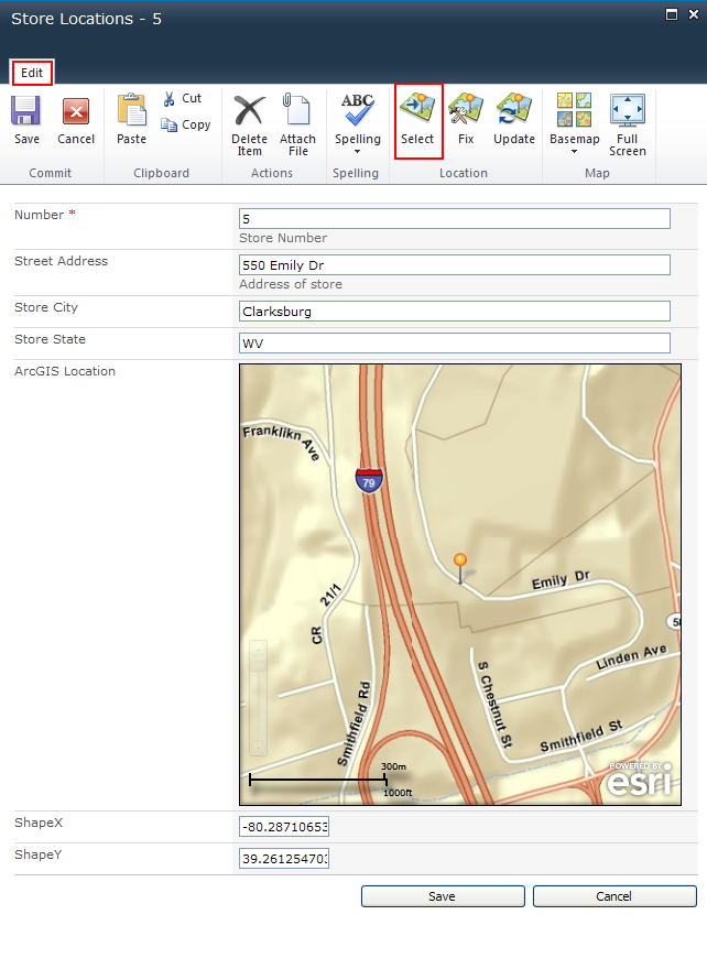
The item's Edit form opens. Click the Select button in the Location group on the ribbon:

-
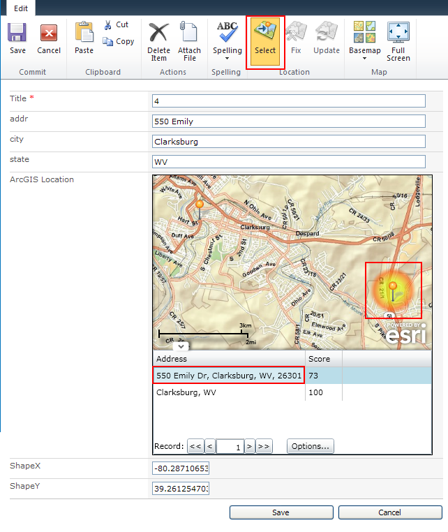
Select the candidate you wish to use by clicking it on the map or by clicking the corresponding row in the table at the bottom of the Location Field. Once you have the desired candidate elected, click the Select button again:

-
The Confirm selection dialog displays. Click the OK button if you are satisfied with the candidate you have chosen. Otherwise, click Cancel:

-
If a task for selecting an address match candidate is associated with this item, the Close associated task dialog displays. Click the OK button if you wish to mark this task as complete:

-
To save the new location and, if applicable, the associated task's status, click the Save button at the bottom of the edit dialog:

Preparing SharePoint data for mapping
Geocoding addresses
Geocoding a list item
Fixing a location


