At times, SharePoint lists may contain columns that store the geographic location of each item as latitude and longitude. Spatially enabling such lists so that they can be displayed on the Map Web Part simply requires adding and configuring an ArcGIS Location Field.
 |
The current version of the ArcGIS Map Web Part only supports adding a location field to lists with WGS84 (World Geodetic System 1984) geographic coordinates. WGS84 is the most widely used geocentric datum and geographic coordinate system today. GPS measurements, for instance, are based on WGS84. For more information on map projections and geographic coordinate systems, see What are Map Projections? |
Add an ArcGIS Location Field to a list
-
Open the list. On the List tab, click the List Settings button:

-
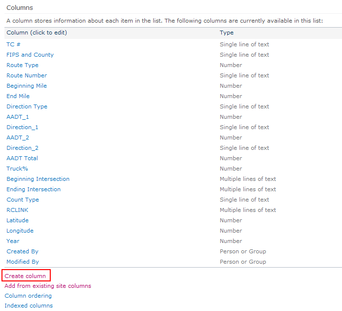
On the List Settings page, click the Create Column button located below the Columns section:

-
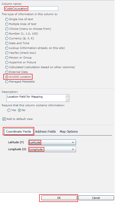
On the Create Column page, specify a name for the column. Then select ArcGIS Location from the radio buttons. A new section, specific to creating a location field, will appear at the bottom of the page. In this section, select the fields containing each item's Latitude (Y) and Longitude (X) using the drop-down menus. Click the OK button:

-
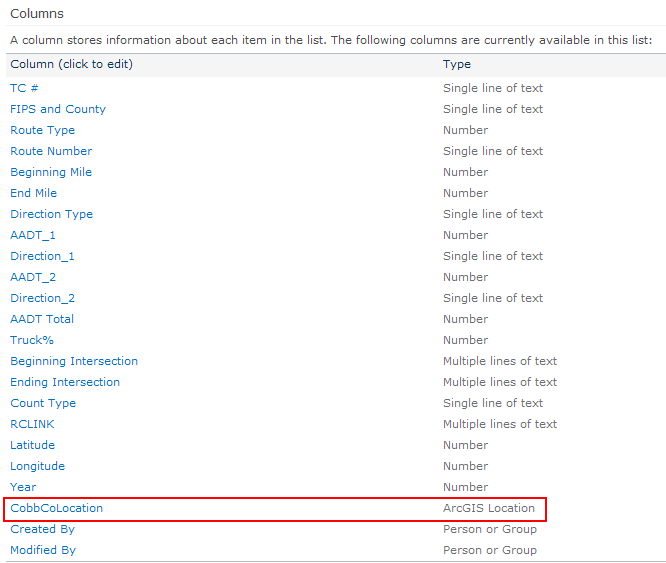
The new column is added to the list:

-
The list is now ready to be added to an ArcGIS Map Web Part by using the web part's Browse functionality. See Browsing SharePoint Sites for detailed information on how to add this content to your map.
Preparing SharePoint data for mapping
About preparing SharePoint data


