| Home | Concepts | API | Samples | |
| Concepts > Rasters > Basic Principles | |
| Raster Bands | |
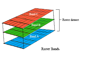 A raster
dataset contains one or more layers called bands. For example, a color image has three bands (red, green, and blue) while a digital elevation model (DEM) has one band
(holding elevation values), and a multispectral image may have many bands. A raster
dataset contains one or more layers called bands. For example, a color image has three bands (red, green, and blue) while a digital elevation model (DEM) has one band
(holding elevation values), and a multispectral image may have many bands.Each raster band contains the actual cell values, as well as some key properties, such as:
Examples of a 1 band raster are
Examples of 3 band raster are
For information on how to use bands in ArcSDE API, click here. |
| feedback |
privacy |
legal |