MapIt™ Spatial Data Services
A MapIt Spatial Data Service is a REST-ful web service that provides access to the databases and tables in a SQL Server instance. The ArcGIS Map Web Part interacts with the Spatial Data Service to make spatially enabled SQL Server tables available for adding to the map.
Adding tables to the map
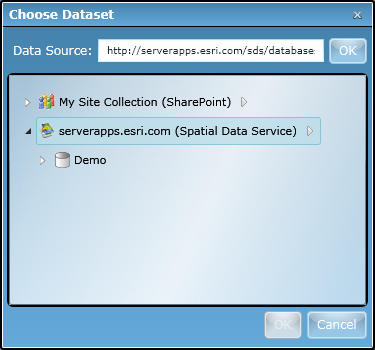
To view the tables hosted by a Spatial Data Service, you need to first add the service as a data source in the Add Data dialog. Simply type the URL to the Spatial Data Service's root (e.g. http://serverapps.esri.com/sds/databases) and hit Enter or click OK. After a few moments, the Spatial Data Service will appear as a new data source node, as shown in the image below. The node will be expanded by default, showing the databases that are available.
To view the tables that are available within a database, simply expand the database node:
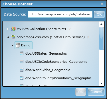
Note: Only tables that have been spatially enabled (e.g. contain SQL Geometry or GeoFields) will be shown. While non-spatial tables can be queried via a Spatial Data Service, the Map Web Part does not support interaction with non-spatial tables.
Once you find the table you want to add to the map, simply select it and click the OK button at the bottom of the Add Data window. The table will be immediately added to the map and shown with a single default symbol. The Properties window also opens so that you can immediately tailor the appearance of the data in the map.
Tip: To explore the contents of a MapIt Spatial Data Service, you can also use the
Services Directory web application. To do so, simply open a browser and navigate to the Spatial Data Service's root URL. Use the Services Directory to navigate databases and tables, discover table information, and initiate operations (such as query).
