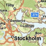

Map Service Name: World_Street_Map
Description: This worldwide street map presents highway-level data for the world and street-level data for the United States, Canada, Japan, Southern Africa, most countries in Europe, parts of Asia, Australia and New Zealand, and parts of South America including Argentina, Brazil, Chile, and Venezuela. This comprehensive street map includes highways, major roads, minor roads, one-way arrow indicators, railways, water features, administrative boundaries, cities, parks, and landmarks, overlaid on shaded relief imagery for added context. The map also includes building footprints for selected areas in the United States and Europe.
The street map was developed by Esri using Esri basemap data, DeLorme basemap layers, AND road data, USGS elevation data, Intact Forest Landscapes (IFL) data for the world; NAVTEQ data for Australia, New Zealand, and South America (Argentina, Brazil, Chile, Venezuela); and TomTom Dynamap® and Multinet® street data for North America and Europe. Coverage for street-level data in Europe includes Andorra, Austria, Belgium, Czech Republic, Denmark, France, Germany, Great Britain, Greece, Hungary, Ireland, Italy, Luxembourg, Netherlands, Norway, Poland, Portugal, San Marino, Slovakia, Spain, Sweden, and Switzerland. Coverage for street-level data elsewhere in the world includes Argentina, Australia, Brazil, Chile, China (Hong Kong only), Colombia, Egypt (Cairo only), Indonesia (Jakarta only), Japan, Mexico, New Zealand, Russia, South Africa, Thailand, Turkey, and Venezuela.
See the Country coverage table to view coverage by country.
View the coverage maps below to learn more about the levels of detail:
Attribution: Sources: Esri, DeLorme, NAVTEQ, TomTom, USGS, Intermap, AND, ESRI Japan, METI, ESRI Hong Kong, ESRI Thailand, Procalculo Prosis
Coordinate System: WGS 1984 Web Mercator (Auxiliary Sphere)
Units of Measure: Decimal degrees
Extent in Decimal Degrees:
Maximum Longitude: 179.999989
Maximum Latitude: 85.000000
Minimum Longitude: -179.999989
Minimum Latitude: -85.000000
Map DPI: 96
Tile Size of Map Cache: 256 pixels by 256 pixels
Map Service Data Format: Map Server Cache in JPG Format
Cached Map Scales: