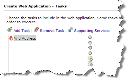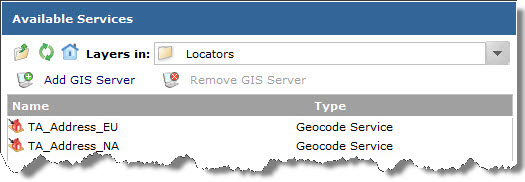

The Geocode Service displays in the Supporting Services dialog.
Continue creating your Web application by completing the remaining panels of the ArcGIS Server Manager wizard.
For ArcGIS users with Internet access, there are some other options for using or developing Web mapping applications using ArcGIS Data Appliance services. This includes ready-to-use, hosted Web Apps that can be used to access Internet accessible GIS services and Web APIs for developing fully customized web applications.
This document includes information on using the locators and routing services included on the ArcGIS Data Appliance with your maps; you can use these services only if you purchased the optional licenses for geocoding and/or routing.
See the following sections for more information:
Accessing ArcGIS Data Appliance locators in a Web mapping application
Topics about creating a Web mapping application
To access an ArcGIS Data Appliance locator in your Web application, you need to make a connection to your ArcGIS Server system:


The Geocode Service displays in the Supporting Services dialog.
Continue creating your Web application by completing the remaining panels of the ArcGIS Server Manager wizard.
NOTE: You can use the locator services only if you purchased the optional license for geocoding.
For information on using the ArcGIS Data Appliance locators with ArcGIS Server Manager .NET, see About publishing a GIS resource to the server under Publishing Services > How to publish services > Publishing a GIS resource to the Server and About the Find Address task under Creating Web Applications > ArcGIS Server Manager > Configuring Tasks > Find Address Task in ArcGIS Server .NET Help.
For information on using the ArcGIS Data Appliance locators with ArcGIS Server Manager Java, see About publishing a GIS resource to the server under How to publish services > How to publish services > Publishing a GIS resource to the server and see "Find Address task" in the Configuring tasks topic under Creating Web Applications > ArcGIS Server Manager in ArcGIS Server for the Java Platform Help.
For information on publishing an ArcGIS Data Appliance routing service and using it in a client application, see the documentation for your ArcGIS Server:
NOTE: You can use the routing services only if you purchased the optional license for routing.
You can find complete instructions for creating a Web mapping application in the topics below from the ArcGIS Server Help. These links go to the help on the Esri website. If you do not have Internet access, you can also get to these topics by opening your local ArcGIS Server Help and viewing the Creating Web Applications book.