The simplest way to get started with the ArcGIS Data Appliance is by using the services to create a basemap or globe. You can also view User Guides for specific applications to learn how to add the services to your new and existing maps.
You can use services from the ArcGIS Data Appliance to build powerful basemaps and globes. You may want to use a basemap as a starting point for incorporating your own data and analysis tasks.
NOTE: The availability of some basemaps and services mentioned in this document may vary depending on the ArcGIS Data Appliance package that you purchased.

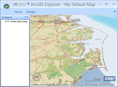
The 3D World Street Map in ArcGIS Explorer
Most of the 2D and 3D basemaps you can build with the ArcGIS Data Appliance are best used by adding your own content on top of the basemap information—for example, you might have an environmental or weather dataset that you would want to overlay on the World Physical or World Satellite basemaps.

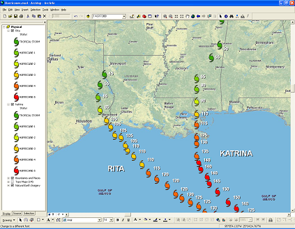
In this example, hurricane path data overlays the 2D World Physical basemap in ArcMap.
Many organizations only maintain datasets and map services for a limited range of scales and extents. You can add your data as "postage stamps" or small blocks of content on top of your basemaps. By wisely setting scale ranges on your content, you can configure the map so that your data overlays or replaces the basemap at the appropriate extent and altitude.
Both ArcGIS Server Web mapping applications and ArcGIS Explorer provide a way for you to expose tasks to your users. For example, you can include a Find Nearby Places add-in with your ArcGIS Explorer map to allow anyone to find places of interest within a specified radius from the the center point of the map. ArcGIS Data Appliance basemaps work well for displaying the results of many tasks. For example, if you built a task or add-in for locating shelters or other facilities, you could choose to place the results on the World Street Map. Using services from the ArcGIS Data Appliance allows you to focus on developing the task or add-in, and saves you the effort of authoring, caching, and serving the map.
If there's an individual service you want to use in a map that you've created, follow the instructions in the user guide links below to learn how to add the service to the application of your choice. The user guides also contain pictures and examples of ways that you can leverage the ArcGIS Data Appliance with your own data.