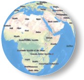
Globe Service Name: ESRI_PlaceLabels_World
Description: This globe presents vector labels for country, state/province, county or equivalent, and city place names for the world. The globe was developed by ESRI using place name data from ESRI, AND, and Tele Atlas. The labels are delivered as a multi-scale, vector annotation service.
Attribution: Copyright:© 2010 ESRI, AND, Tele Atlas
Coordinate System: Geographic (Latitude-Longitude)
Units of Measure: Decimal degrees
Extent in Decimal Degrees:
Maximum Longitude: 180
Maximum Latitude: 90
Minimum Longitude: -180
Minimum Latitude: -90
Minimum Viewing Distance: 2000 miles down to 50 miles
Globe Service Data Format: Globe Server Cache
Globe Service Size: 1.30 MB
Globe Service Size on Disk: 30.1 MB
Globe Service Number of Files: 11,563