| URL | http://baoapi.esri.com/rest/report/GeofenceInfo |
|---|
Obtain a list of geographic features from the analysis data layers accessible from the current user account.
Output
The Geofence Info service queries available features from any data layer based on the geographic constraints imposed on the API account. The result of this service is a GeofenceInfoOutput object which contains all of the available feature/area names and their corresponding IDs that satisfy the string-based query on the data layer. Results will vary depending on the geographic constraints on the account.
Additionally, a polygon FeatureSet may be optionally generated and returned in the output results. This FeatureSet may be used to obtain the geographic coordinates of the areas for mapping or rendering in a client application.
Description
The Geofence Info service produces a list of feature/area names and their corresponding IDs based on the result of a string-based query on a data layer and on user account geofence constraints.
After looking up these IDs, the client application developer may view the list of geographic features which she has access to. Feature IDs obtained from the list can be used to specify one or more geographic features/areas in a Summary Reports analysis using StdLayers as the value for the Boundaries parameter. Features/areas in the data layers are often identified by standardized FIPS codes which generally correspond to the geography feature IDs. The Geofence Info service can be leveraged to look up these IDs which are available to the current user.
Usage Tips
- Take advantage of all of the available analysis data layers in REST services. Use Get Standard Geography Levels to look up the available data layers and their corresponding IDs matching the user account geofence constraints.
- Use the Geofence Info service to determine access/availability to specific geographic features/areas from a given API subscription account.
- Determine which geographic features the account has access to and specify them in subsequent analysis such as Summary Reports and Benchmark Report as StdLayers
You can provide arguments to the Geofence Info service as defined in the parameters table below.
Parameters
| Parameter | Details |
|---|---|
| GeoLevelID (Required) |
Description:
A data layer ID to query.
Syntax: |
| Token (Required) |
Description:
A valid REST services token string.
Syntax: Notes: The value associated with the Token parameter is for example purposes only. See Get Token for more information on obtaining a token. |
| ActiveDatasetID |
Description:
Specify a dataset to perform Online API tasks or operations.
Default: USA Notes: See the Get Datasets task to dynamically query the available dataset IDs. |
| Callback |
Description: Wrap the JSON or PJSON response in a named function that can be executed by client-side JavaScript upon receipt.
Default: Notes:
|
| f |
Description:
The response format.
Default: HTML
Syntax: |
| OutputType |
Description: GetFeatureClass returns the serialized geometry and attributes of the output areas in the response. If the list of operations is empty, an array of standard geography feature IDs and names is returned in the GeofenceInfoOutput result object.
Default:
Notes: Only GetFeatureClass is currently supported. Omit this parameter and value, if no geometry is required and to minimize the size of the response payload. |
| SearchString |
Description:
A string of characters which is used to query the data layer specified by the GeoLevelID parameter value.
Syntax: |
Example Usage
Example 1: Obtain the list of all U.S. Census tracts accessible from the current API subscription account. Additionally, obtain the corresponding geometry (polygon FeatureSet) and graphic image representing the accessible geographic features.
Request Example (1)
Notes: The response payload can be large due to the specification of GetFeatureClass in the OutputType parameter. Omit this parameter to retrieve the list without the polygon geometries.
The Request Example is hyperlinked with the URL-encoded request URI without a valid token parameter value. Include a valid token value to submit. See Get Token for more information on obtaining a token.
Example Response
JSON Response Syntax
Notes: When areas are specified in other analyses, the values associated with their feature IDs are typically specified.
JSON Response Example
{
  "TaskMessagesArray": [],
  "StdGeographiesFeatures": [
    {
      "FeatureID": "06071007301",
      "FeatureName": "06071007301"
    },
    {
      "FeatureID": "06071007800",
      "FeatureName": "06071007800"
    },

    ...

    {
      "FeatureID": "06071008600",
      "FeatureName": "06071008600"
    }
  ],
  "RecordSet": {
    "geometryType": "esriGeometryPolygon",
    "spatialReference": {"wkid": 4326},
    "features": [
      {
        "attributes": {
          "ID": "06071008500",
          "Gen2_Length": 0.27680121712515127,
          "Gen2_Area": 0.0025918185791268225
        },
        "geometry": {
          "rings": [
            [
              [-117.066024, 34.004074],
              [-117.135041, 34.00397],

              ...

              [-117.066024,34.004074]
            ]
          ],
          "spatialReference": {"wkid": 4326}
        }
      },
      {
        "attributes": {
          "ID": "06071008600",
          "Gen2_Length": 0.32809403429573064,
          "Gen2_Area": 0.004200010941483622
        },
        "geometry": {
          "rings": [
            [
              [-117.036539, 34.0684],
              [-117.042867, 34.06833],

              ...

              [-117.036539, 34.0684]
            ]
          ],
          "spatialReference": {"wkid": 4326}
        }
      },

      ...

      {
        "attributes": {
          "ID": "06071008404",
          "Gen2_Length": 0.049442110817163376,
          "Gen2_Area": 1.2628456739656116E-4
        },
        "geometry": {
          "rings": [
            [
              [-117.156408, 34.062809],
              [-117.156354, 34.059817],

              ...

              [-117.156408, 34.062809]
            ]
          ],
          "spatialReference": {"wkid": 4326}
        }
      }
    ]
  }
}
Notes: The response has been abbreviated in the example where "..." is noted.
The default map projection is GCS_WGS_1984 (WKID: 4326).
JSON Response Example (1) Rendered with the ArcGIS API for JavaScript
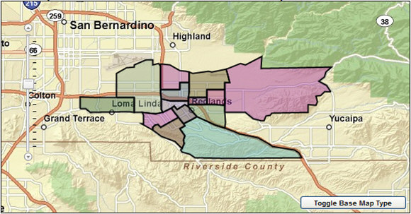
Notes: The thematic shading of the features is for illustrative purposes only and is not representative of their corresponding attribute values.