


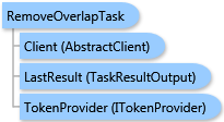
 Object Model
Syntax
Remarks
This task removes cannibalization between trade areas generated in the Business Analyst Server or custom derived trade areas. Overlap is removed using Thiessen polygons or the grid-based approach to find the midline between the intersecting areas.
The result of this task is a ESRI.ArcGIS.Client.BACore.TaskResultOutput object, which is compatible with ArcGIS Server's mapping APIs. FeatureSet, MapImage, and an array of ESRI.ArcGIS.Client.BACore.ReportInfo objects can be returned in it depending on the task output options requested. Additionally, the output analysis layer and/or report can be stored to the Business Analyst Server repository.
Inheritance Hierarchy
System.Object
ESRI.ArcGIS.Client.BACore.Client.AbstractTask
ESRI.ArcGIS.Client.BACore.Client.BATask<TResult,TEventArgs>
ESRI.ArcGIS.Client.BAServer.Tasks.BAServerTask<TResult>
ESRI.ArcGIS.Client.BAServer.Tasks.TradeAreas.RemoveOverlapTask
Requirements
Target Platforms: Windows 98, Windows NT 4.0, Windows Millennium Edition, Windows 2000, Windows XP Home Edition, Windows XP Professional, Windows Server 2003 family, Windows Vista, Windows Server 2008 family