


 Object Model
Syntax
Remarks
The GeoLevelIDs parameter specifies IDs of the standard geography levels to search geography features in.
The location point can be specified in one of three ways—by postal address, by geographic coordinates, and by ZIP code.
- The
Addressparameter specifies postal address fields. - The
Pointparameter contains geographic coordinates of the map point. - The
ZIPparameter specifies the location ZIP code. The centroid point of the given ZIP is used.
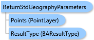
Along with an individual point location, a point layer can be specified using the Points parameter. In this case, features matching to the given locations are combined together and the combined feature ID and Name is returned for a geography level. The ID of a combined feature can be used in the GeographyIDs parameter of the ESRI.ArcGIS.Client.BACore.StandardLayer and ESRI.ArcGIS.Client.BAServer.Tasks.TradeAreas.StandardLevelsOfGeographyParameters types.
All the ways for specifying geography locations are mutually exclusive. Only one parameter from Address, Point, ZIP, and Points should be specified and others should be missing.
Example
| C# |  Copy Code Copy Code |
|---|---|
ReturnStdGeographyParameters parameters = new ReturnStdGeographyParameters(); // Set standard geography levels to find geography features in. parameters.GeoLevelIDs = new List<string>(){"US.Counties"}; // Set address location fields. parameters.Address = new List<string>(){"8103 Sandy Spring Rd.", "Laurel", "MD", "20707"}; returnStdGeographyTask.ExecuteAsync(parameters, new AsyncResponder(resultHandler, faultHandler)); | |
Inheritance Hierarchy
System.Object
ESRI.ArcGIS.Client.BACore.Client.BABaseParameters
ESRI.ArcGIS.Client.BACore.Client.BAUtilityParameters
ESRI.ArcGIS.Client.BAServer.Tasks.StdGeographies.ReturnStdGeographyParameters
Requirements
Target Platforms: Windows 98, Windows NT 4.0, Windows Millennium Edition, Windows 2000, Windows XP Home Edition, Windows XP Professional, Windows Server 2003 family, Windows Vista, Windows Server 2008 family