


 Object Model
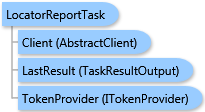
Syntax
Remarks
This task generates a report that will determine the proximity of locations to a given set of center points. For example, you can use this method to illustrate the proximity of competitors to each store location. This report will list and display all the competitor locations that are closest to each store and allows you to examine their geographic patterns and distribution.
The result of this task is a ESRI.ArcGIS.Client.BACore.TaskResultOutput object, which is compatible with ArcGIS Server's mapping APIs. FeatureSet, MapImage, and an array of ESRI.ArcGIS.Client.BACore.ReportInfo objects can be returned depending on the task output options requested. The array of ReportInfo items if returned contains the single report. Additionally, the output analysis layer and/or report can be stored to the Business Analyst Server repository.
Inheritance Hierarchy
System.Object
ESRI.ArcGIS.Client.BACore.Client.AbstractTask
ESRI.ArcGIS.Client.BACore.Client.BATask<TResult,TEventArgs>
ESRI.ArcGIS.Client.BAServer.Tasks.BAServerTask<TResult>
ESRI.ArcGIS.Client.BAServer.Tasks.Reports.LocatorReportTask
Requirements
Target Platforms: Windows 98, Windows NT 4.0, Windows Millennium Edition, Windows 2000, Windows XP Home Edition, Windows XP Professional, Windows Server 2003 family, Windows Vista, Windows Server 2008 family