


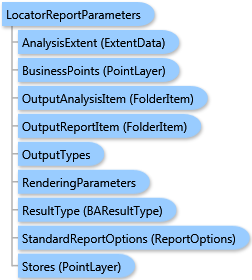
 Object Model
Syntax
Remarks
The analysis can be restricted to an analysis extent if the AnalysisExtent parameter is specified. Optional SingleStoreID parameter restricts the analysis to a single store.
The BusinessesSearchMethod parameter specifies the algorithm for selecting the business points nearest to every store location:
| Value | Description |
|---|---|
BusinessesSearchMethod.esriFindClosest |
Selects not more closest business points than the given number specified with the ClosestBusinessesCount parameter. |
BusinessesSearchMethod.esriWithinRange |
Selects all business points that fall within a predefined distance specified with the NearestDistance and NearestDistanceUnits parameters. For example, you can select all business points that are within five miles of each store location. |
The CalculationMethod parameter specifies a method for distance calculation from within drive time, drive distance, or straight-line distance variants.
The locator report can be generated in the portrait or landscape mode specified with the ReportOrientation parameter. In the portrait mode, the number of attributes of business points shown in columns is limited to 4. In the landscape mode, up to 6 attributes of business points can be shown. The attribute fields of the business layer to be exported to the report and their alias names to be shown in captions of columns are specified with the FieldNames and FieldAliases parameter, respectively.
Output options for this task include rendering an output image (OutputTypes.GetMapImage), creating a feature class for subsequent analysis (OutputTypes.GetFeatureClass), and/or creating a report (OutputTypes.GetReport). If no output options are specified, the required output options are specified as follows. If the RenderingParameters parameter is specified, the image output is requested. If the StandardReportOptions parameter is specified, the report is requested. If the OutputAnalysisItem parameter is specified, the output analysis feature class will be stored in the repository. If RenderingParameters, StandardReportOptions, and OutputAnalysisItem parameters are missing, the feature class output is requested.
Example
| C# |  Copy Code Copy Code |
|---|---|
LocatorReportParameters parameters = new LocatorReportParameters(); // The PointLayer type could take either data as // ESRI.ArcGIS.Client.Tasks.FeatureSet, ESRI.ArcGIS.Client.BAServer.FolderItem, // or a list of ESRI.ArcGIS.Client.BACore.PointRecord items, e.g. //List<PointRecord> points = new List<PointRecord>() { // new PointRecord("Store 1", "Steiner St. & Geary Blvd", "1", 37.78415, -122.4346)}; // Set Stores as a list of PointRecord using implicit cast operator. parameters.Stores = points; // Set BusinessPoints with a valid data type. parameters.BusinessPoints = businessPoints; // Set fields of the BusinessPoints layer to be exported to the report. parameters.FieldNames = new List<string>(){ "NAME", "DESCR" }; // Set aliases of fields to be shown in the report. parameters.FieldAliases = new List<string>(){ "Name", "Description" }; // Set report parameters. parameters.StandardReportOptions = new ReportOptions("PDF"); locatorReportTask.ExecuteAsync(parameters, new AsyncResponder(resultHandler, faultHandler)); | |
Inheritance Hierarchy
System.Object
ESRI.ArcGIS.Client.BACore.Client.BATaskParameters
ESRI.ArcGIS.Client.BACore.Client.StandardReportParameters
ESRI.ArcGIS.Client.BAServer.Tasks.AnalysisAndReportParameters
ESRI.ArcGIS.Client.BAServer.Tasks.Reports.LocatorReportParameters
Requirements
Target Platforms: Windows 98, Windows NT 4.0, Windows Millennium Edition, Windows 2000, Windows XP Home Edition, Windows XP Professional, Windows Server 2003 family, Windows Vista, Windows Server 2008 family