


 Object Model
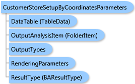
Syntax
Remarks
Point data for Customer/Store Setup are specified by either the DataTable or Points parameters (these parameters are mutually exclusive). In the first case, the names of fields specified by parameter of this task should match the fields of the input data table, and the output layer will contain all fields specified in the input data table. In the last case, the customer/store layer will contain fields imported from PointRecord items.
The LatitudeFieldName and LongitudeFieldName parameters are used for identifying coordinate fields in the input record set specified with the DataTable object.
The GeocodeCustomers parameter specifies the Setup type: the true value (default) means Customer Setup and the false value means Store Setup.
For Customer Setup, the NameField and LinkField parameters can be specified. A new customer ID field is created.
For Store Setup, the StoreIDField parameter should be specified when the DataTable parameter is used. The NameField parameter can be specified. The CreateNewIDField parameter specifies whether to create a new store ID field or not. If its value is true, a new store ID field is added to the output layer with the name specified by the StoreIDField parameter. If this name already exists in the input fields, it is slightly modified to be unique. For example, if the input data already contains a field with a STORE_ID name and you try to create a new store ID field with the same name, a new field with the STORE_ID_1 name will be created in the output layer.
Output options for this task include rendering an output image (OutputTypes.GetMapImage) and/or creating a feature class for subsequent analysis (OutputTypes.GetFeatureClass). If no output options are specified, the required output options are specified as follows. If the RenderingParameters parameter is specified, the image output is requested. If the OutputAnalysisItem parameter is specified, the output analysis feature class will be stored in the repository. If both RenderingParameters and OutputAnalysisItem parameters are missing, the feature class output is requested.
Example
| C# |  Copy Code Copy Code |
|---|---|
CustomerStoreSetupByCoordinatesParameters parameters = new CustomerStoreSetupByCoordinatesParameters(); // Points is a list of ESRI.ArcGIS.Client.BACore.PointRecord items, e.g. //List<PointRecord> points = new List<PointRecord>() { new PointRecord("store_1", "Store 1", "1", 34.052074, -117.207841) }; parameters.Points = points; customerStoreSetupByCoordinatesTask.ExecuteAsync(parameters, new AsyncResponder(resultHandler, faultHandler)); | |
Inheritance Hierarchy
System.Object
ESRI.ArcGIS.Client.BACore.Client.BATaskParameters
ESRI.ArcGIS.Client.BACore.Client.AnalysisParameters
ESRI.ArcGIS.Client.BAServer.Tasks.AnalysisParameters
ESRI.ArcGIS.Client.BAServer.Tasks.CustomerStoreSetup.CustomerStoreSetupByCoordinatesParameters
Requirements
Target Platforms: Windows 98, Windows NT 4.0, Windows Millennium Edition, Windows 2000, Windows XP Home Edition, Windows XP Professional, Windows Server 2003 family, Windows Vista, Windows Server 2008 family