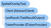
The Spatial Overlay task allows you to summarize demographic data for a set of custom trade areas and add summarized values as attribute fields to the output feature class.
The result of this task is a ESRI.ArcGIS.Client.BACore.TaskResultOutput object, which is compatible with ArcGIS Server's mapping APIs. FeatureSet and MapImage objects can be returned depending on the task output options requested. Additionally, the output analysis layer can be stored to the Business Analyst Server repository.
System.Object
ESRI.ArcGIS.Client.BACore.Client.AbstractTask
ESRI.ArcGIS.Client.BACore.Client.BATask<TResult,TEventArgs>
ESRI.ArcGIS.Client.BAServer.Tasks.BAServerTask<TResult>
ESRI.ArcGIS.Client.BAServer.Tasks.Analyses.SpatialOverlayTask
Target Platforms: Windows 98, Windows NT 4.0, Windows Millennium Edition, Windows 2000, Windows XP Home Edition, Windows XP Professional, Windows Server 2003 family, Windows Vista, Windows Server 2008 family


