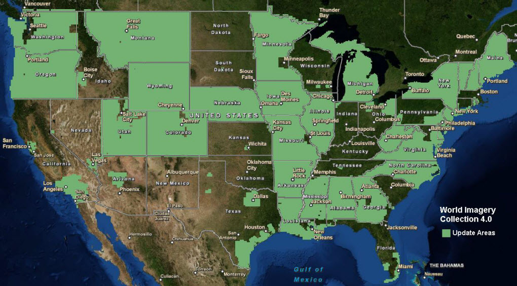
For the World Imagery Collection 4.0, the World Imagery service was updated with more recent and detailed imagery for the United States. This includes updates of imagery in the areas shown in the image below. Detailed information for these updates is available in the World Imagery service description and in the associated metadata layer that is provided with your source documents.
