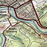

Map Service Name: USA_Topo_Maps
Description: This map presents land cover imagery for the world and detailed topographic maps for the United States. The map includes the National Park Service (NPS) Natural Earth physical map at 1.24km per pixel for the world at small scales, i-cubed eTOPO 1:250,000-scale maps for the contiguous United States at medium scales, and National Geographic TOPO! 1:100,000 and 1:24,000-scale maps (1:250,000 and 1:63,000 in Alaska) for the United States at large scales. The TOPO! maps are seamless, scanned images of United States Geological Survey (USGS) paper topographic maps.
Attribution: Copyright:© 2010 National Geographic Society, i-cubed
Coordinate System: WGS 1984 Web Mercator (Auxiliary Sphere)
Units of Measure: Decimal degrees
Extent in Decimal Degrees:
Maximum Longitude: 179.999989
Maximum Latitude: 85.000000
Minimum Longitude: -179.999989
Minimum Latitude: -85.000000
Map DPI: 96
Tile Size of Map Cache: 256 pixels by 256 pixels
Map Service Data Format: Map Server Cache in JPG Format
Map Service Size: 296 GB
Map Service Size on Disk: 345 GB
Map Service Number of Files: 24,567,890
Cached Map Scales: