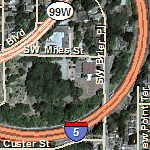

Map Service Name: World_Transportation
Description: This map presents transportation data, including highways, roads, railroads, and airports for the world. The map was developed by Esri using Esri highway data, TomTom, DeLorme basemap layers, and Automotive Navigation Data (AND) road and railroad data for the world; NAVTEQ data for Australia, New Zealand, and South America (Argentina, Brazil, Chile, Venezuela); and TomTom, Dynamap® and Multinet® street data for North America and Europe.
View the coverage maps below to learn more about the levels of detail:
Attribution: Copyright:© 2011 Esri, DeLorme, NAVTEQ, TomTom, AND
Coordinate System: WGS 1984 Web Mercator (Auxiliary Sphere)
Units of Measure: Decimal degrees
Extent in Decimal Degrees:
Maximum Longitude: 179.999989
Maximum Latitude: 85.000000
Minimum Longitude: -179.999989
Minimum Latitude: -85.000000
Map DPI: 96
Tile Size of Map Cache: 256 pixels by 256 pixels
Map Service Data Format: Map Server Cache in PNG32 Format
Cached Map Scales: