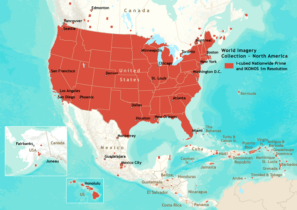
Imagery for areas in North America and Central America are included in the World Imagery Collection.
It includes 1m or better resolution i-cubed Nationwide Prime imagery for the contiguous United States, and GeoEye IKONOS 1m resolution imagery for Hawaii, parts of Alaska, and a number of metropolitan areas in Canada, Central America, and the Caribbean.
Areas covered include: Antigua and Barbuda, Aruba, Barbados, Belize, Bermuda, Canada, Cayman Islands, Costa Rica, Cuba, Dominica, Dominican Republic, El Salvador, Grenada, Guadeloupe, Guatemala, Haiti, Honduras, Jamaica, Martinique, Mexico, Montserrat, Nicaragua, Panama, Puerto Rico, Saint Kitts and Nevis, Saint Lucia, Saint Vincent and the Grenadines, The Bahamas, Trinidad and Tobago, Turks and Caicos Islands, United States, and Virgin Islands. View a list of the cities included in HTML or Excel (XLS) format, or view a list of the towns included in HTML or Excel (XLS) format.