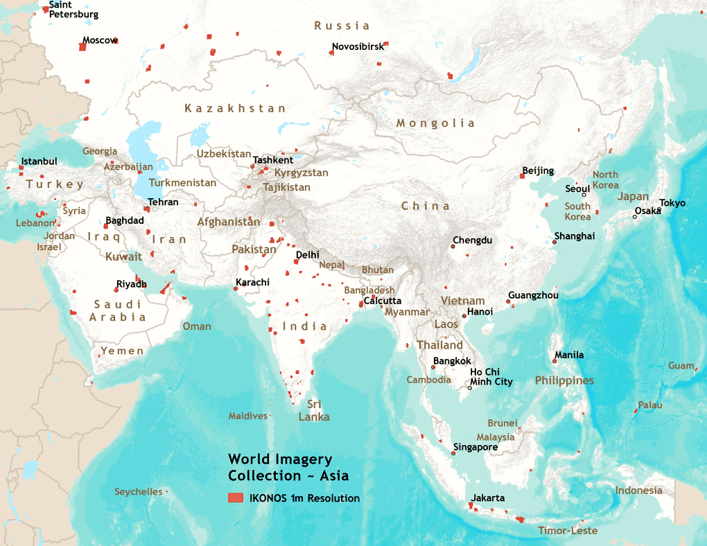
GeoEye IKONOS 1m resolution imagery for a number of areas in Asia is included in the World Imagery Collection. Areas covered include: Afghanistan, Azerbaijan, Bangladesh, Bhutan, Brunei, Cambodia, China, Georgia, Guam, India, Indonesia, Iran, Iraq, Kazakhstan, Kuwait, Kyrgystan, Laos, Lebanon, Malaysia, Maldives, Myanmar, Nepal, North Korea, Oman, Pakistan, Palau, Philippines, Russia, Qatar, Saudi Arabia, Seychelles, Singapore, South Korea, Syria, Tajikistan, Thailand, Timor-Leste, Turkey, United Arab Emirates, Uzbekistan, Vietnam, and Yemen. View a list of the cities included in HTML or Excel (XLS) format, or view a list of the towns included in HTML or Excel (XLS) format.