


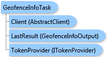
 Object Model
Syntax
Remarks
This task queries available features from a standard geography data layer according to the Community Analyst API user account geofence constraints.
When specifying the request with a Community Analyst API user account with geofence constraints, the geofence criteria is applied before the output response is generated. The output response will contain a list of feature IDs and names in a GeofenceInfoOutput.StdGeographiesFeatures array. If no matching features were found by the query criteria or all of the features were rejected by the geofence constraints, the array will be null.
Additionally, a map image and a feature class can be generated for resulting features and returned in the output results depending on the output options selected. If you only need feature IDs and names as the output, you can pass null as the OutputTypes parameter.
Inheritance Hierarchy
System.Object
ESRI.ArcGIS.Client.BACore.Client.AbstractTask
ESRI.ArcGIS.Client.BACore.Client.BATask<TResult,TEventArgs>
ESRI.ArcGIS.Client.BAO.Tasks.BAOnlineTask<TResult>
ESRI.ArcGIS.Client.BAO.Tasks.Geofence.GeofenceInfoTask
Requirements
Target Platforms: Windows 98, Windows NT 4.0, Windows Millennium Edition, Windows 2000, Windows XP Home Edition, Windows XP Professional, Windows Server 2003 family, Windows Vista, Windows Server 2008 family