


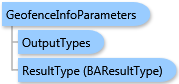
 Object Model
Syntax
Remarks
The standard geography data layer is specified by the GeoLevelID property value. The query criteria is specified by the SearchString property value. This query is performed on the name and ID attributes of every available feature in the standard geography layer. All available features in the specified standard geography layer are requested when no value for the SearchString property is specified.
When specifying the request with a Business Analyst Online API user account with geofence constraints, the resulting features are filtered with geofence criteria.
Output options for this task include creating a feature class for subsequent analysis (OutputTypes.GetFeatureClass) and rendering output image (OutputTypes.GetMapImage). If output options are not specified, the output will contain the StdGeographiesFeatures only.
Example
| C# |  Copy Code Copy Code |
|---|---|
GeofenceInfoParameters parameters = new GeofenceInfoParameters(); parameters.GeoLevelID = "US.ZIP5"; parameters.SearchString = "923"; // Optionally set GetFeatureClass and GetMapImage to true parameters.OutputTypes.GetFeatureClass = true; parameters.OutputTypes.GetMapImage = true; geofenceInfoTask.ExecuteAsync(parameters, new AsyncResponder(resultHandler, faultHandler)); | |
Inheritance Hierarchy
System.Object
ESRI.ArcGIS.Client.BACore.Client.BATaskParameters
ESRI.ArcGIS.Client.BACore.Client.AnalysisParameters
ESRI.ArcGIS.Client.BAO.Tasks.Geofence.GeofenceInfoParameters
Requirements
Target Platforms: Windows 98, Windows NT 4.0, Windows Millennium Edition, Windows 2000, Windows XP Home Edition, Windows XP Professional, Windows Server 2003 family, Windows Vista, Windows Server 2008 family