


 Object Model
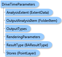
Syntax
Remarks
Drive time distances should be limited to 90 minutes. Realistic analyses beyond this threshold should be run using simple rings.
Valid numeric distances must be used when defining drive time values. Negative distances cannot be used.
The Donut option creates output polygons that are bands. For example, if three radii are entered with values of 1, 3, and 5 minutes, three output bands would be created with 0–1, 1–3, and 3–5 minute drive time trade areas.
Set the measure units to minutes if you want to create drive time trade areas.
To compensate for traffic patterns in drive time analyses, adjust driving distances accordingly. For example, if you are looking at a time of day when traffic patterns are heavy (such as rush hour) and the drive time takes twice as long, then you can halve the drive time to reflect this pattern.
The CreateDetailedBorder option allows you to draw drive time boundaries that will ignore areas that cannot be driven to. This may create holes in your drive time boundary layer.
Output options for this task include rendering an output image (OutputTypes.GetMapImage), creating a feature class for subsequent analysis (OutputTypes.GetFeatureClass), and/or creating a report (OutputTypes.GetReport). If no output options are specified, the required output options are specified as follows. If the RenderingParameters parameter is specified, the image output is requested. If the ReportOptions parameter is specified, the report is requested. If the OutputAnalysisItem parameter is specified, the output analysis feature class will be stored in the repository. If RenderingParameters, ReportOptions, and OutputAnalysisItem parameters are missing, the feature class output is requested.
Example
| C# |  Copy Code Copy Code |
|---|---|
DriveTimeParameters parameters = new DriveTimeParameters(); // The PointLayer type could take either data as // ESRI.ArcGIS.Client.Tasks.FeatureSet, ESRI.ArcGIS.Client.BAServer.FolderItem, // or a list of ESRI.ArcGIS.Client.BACore.PointRecord items, e.g. //List<PointRecord> points = new List<PointRecord>() { // new PointRecord("Store 1", "Steiner St. & Geary Blvd", "1", 37.78415, -122.4346)}; // Set Stores as a list of PointRecord using implicit cast operator. parameters.Stores = points; // The StoreIDField parameter is ignored if stores are specified as a list of PointRecord. //parameters.StoreIDField = "STORE_ID"; // Optionally restrict analysis to ExtendData object specified with myExtent. //parameters.AnalysisExtent = myExtent; // Set drive time areas radii. parameters.Radii = new List<double>(){ 3, 5, 10 }; // DriveTimeUnits.esriDriveTimeUnitsMinutes is the default value for DistanceUnits. //parameters.DistanceUnits = DriveTimeUnits.esriDriveTimeUnitsMinutes; // false is the default value for BuildNonOverlappedDriveTimes. //parameters.BuildNonOverlappedDriveTimes = false; // false is the default value for Donut. //parameters.Donut = false; // false is the default value for createDetailedBorder. //parameters.CreateDetailedBorder = false; // Set report options. ReportOptions options = new ReportOptions("PDF", "Age by Income Profile"); options.Header = new ReportHeader("3-5-10 min Drive Time Study Areas"); parameters.ReportOptions = new List<ReportOptions>(){ options }; driveTimeTask.ExecuteAsync(parameters, new AsyncResponder(resultHandler, faultHandler)); | |
Inheritance Hierarchy
System.Object
ESRI.ArcGIS.Client.BACore.Client.BATaskParameters
ESRI.ArcGIS.Client.BACore.Client.SummaryReportParameters
ESRI.ArcGIS.Client.BAServer.Tasks.TradeAreas.TradeAreaTaskParameters
ESRI.ArcGIS.Client.BAServer.Tasks.TradeAreas.DriveTimeParameters
Requirements
Target Platforms: Windows 98, Windows NT 4.0, Windows Millennium Edition, Windows 2000, Windows XP Home Edition, Windows XP Professional, Windows Server 2003 family, Windows Vista, Windows Server 2008 family