


 Object Model
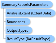
Syntax
Remarks
The summarization can be restricted to an analysis extent if the AnalysisExtent parameter is specified. Optional SingleAreaID parameter restricts the summarization to a single area of the boundary layer. The summarization can be applied to individual features, to all features, and to both individual and all features. This behavior is controlled with the ReportSummarizationOptions parameter. Default is the summarization by individual features.
An optional AreaIDField parameter specifies a field of the Boundaries layer uniquely identifying an area. If this parameter is omitted, the area ID field is recognized as follows: if the Boundaries layer is a standard layer, the "ID" field is used; otherwise, the "AREA_ID" field is used. Report items are usually sorted by area ID field values having the form "storeID_ringID". If the area ID field has a value non-confirming to this template, the RingIDField and StoreIDField parameters can be specified to provide the proper sorting.
Output options for this task include creating a report (OutputTypes.GetReport). You need not specify the output options for this task because the GetReport output type is set by default.
Example
| C# |  Copy Code Copy Code |
|---|---|
SummaryReportsParameters parameters = new SummaryReportsParameters(); // The Boundaries type could take either data as // ESRI.ArcGIS.Client.Tasks.FeatureSet, ESRI.ArcGIS.Client.BAServer.FolderItem, // or ESRI.ArcGIS.Client.BACore.StandardLayer, e.g. //Boundaries boundaries = new Boundaries(new StandardLayer("US.ZIP5", zipCodesArray)); // Set Boundaries with a valid data type. parameters.Boundaries = boundaries; // Set the attribute field name in the Boundaries layer which is associated with unique area IDs. // "ID" is the default value for AreaIDField in the case of StandardLayer. // In other cases, "AREA_ID" is the default value. //parameters.AreaIDField = "ID"; // Set report parameters. parameters.ReportOptions = new List<ReportOptions>() { new ReportOptions("PDF", "Age by Income Profile"), new ReportOptions("PDF", "Age by Sex Profile") }; summaryReportsTask.ExecuteAsync(parameters, new AsyncResponder(resultHandler, faultHandler)); | |
Inheritance Hierarchy
System.Object
ESRI.ArcGIS.Client.BACore.Client.BATaskParameters
ESRI.ArcGIS.Client.BACore.Client.SummaryReportParameters
ESRI.ArcGIS.Client.BAServer.Tasks.Reports.SummaryReportsParameters
Requirements
Target Platforms: Windows 98, Windows NT 4.0, Windows Millennium Edition, Windows 2000, Windows XP Home Edition, Windows XP Professional, Windows Server 2003 family, Windows Vista, Windows Server 2008 family