


 Object Model
Syntax
Remarks
This task allows you to take point data (e.g. customer data) in Business Analyst along with any associated volumetric data and sum that data up to any boundary layer (e.g. Census Tracts). For example, if you needed to see the distribution of the sales data associated with your customer points across the ZIP Codes in your market, this endpoint would allow you to see total sales associated with each ZIP Code of your interest. It would perform this function by automatically selecting all the points which fall into each ZIP Code and then summing up the selected fields to each ZIP Code boundary.
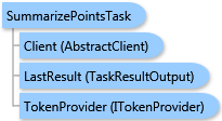
The result of this task is a ESRI.ArcGIS.Client.BACore.TaskResultOutput object, which is compatible with ArcGIS Server's mapping APIs. FeatureSet, MapImage, and an array of ESRI.ArcGIS.Client.BACore.ReportInfo objects can be returned depending on the task output options requested. The array of ReportInfo items if returned contains the single report. Additionally, the output analysis layer and/or report can be stored to the Business Analyst Server repository.
Inheritance Hierarchy
System.Object
ESRI.ArcGIS.Client.BACore.Client.AbstractTask
ESRI.ArcGIS.Client.BACore.Client.BATask<TResult,TEventArgs>
ESRI.ArcGIS.Client.BAServer.Tasks.BAServerTask<TResult>
ESRI.ArcGIS.Client.BAServer.Tasks.Reports.SummarizePointsTask
Requirements
Target Platforms: Windows 98, Windows NT 4.0, Windows Millennium Edition, Windows 2000, Windows XP Home Edition, Windows XP Professional, Windows Server 2003 family, Windows Vista, Windows Server 2008 family