


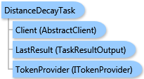
 Object Model
Syntax
Visual Basic (Declaration)
C#
Remarks
The result of this task is a ESRI.ArcGIS.Client.BACore.TaskResultOutput object, which is compatible with ArcGIS Server's mapping APIs. FeatureSet, MapImage, and an array of ESRI.ArcGIS.Client.BACore.ReportInfo objects can be returned depending on the task output options requested. The array of ReportInfo items if returned contains the single report. Additionally, the output analysis layer and/or report can be stored to the Business Analyst Server repository.
Inheritance Hierarchy
System.Object
ESRI.ArcGIS.Client.BACore.Client.AbstractTask
ESRI.ArcGIS.Client.BACore.Client.BATask<TResult,TEventArgs>
ESRI.ArcGIS.Client.BAServer.Tasks.BAServerTask<TResult>
ESRI.ArcGIS.Client.BAServer.Tasks.Reports.DistanceDecayTask
Requirements
Target Platforms: Windows 98, Windows NT 4.0, Windows Millennium Edition, Windows 2000, Windows XP Home Edition, Windows XP Professional, Windows Server 2003 family, Windows Vista, Windows Server 2008 family