


 Object Model
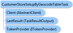
Syntax
Remarks
Use the Customer/Store Setup to define and generate a new store/customer layer, an object that includes information about your stores, branches, offices, or customers. Once you define a store/customer layer, you can use it later in a map, analysis, or report.
To define a store/customer layer, this task uses geo-intelligent information contained in the input GeocodeData parameter. Before performing this task, you may need to create a table and import it to the Business Analyst Server repository.
The result of this task is a ESRI.ArcGIS.Client.BACore.TaskResultOutput object, which is compatible with ArcGIS Server's mapping APIs. FeatureSet and MapImage objects can be returned depending on the task output options requested. Additionally, the output analysis layer can be stored to the Business Analyst Server repository.
Inheritance Hierarchy
System.Object
ESRI.ArcGIS.Client.BACore.Client.AbstractTask
ESRI.ArcGIS.Client.BACore.Client.BATask<TResult,TEventArgs>
ESRI.ArcGIS.Client.BAServer.Tasks.BAServerTask<TResult>
ESRI.ArcGIS.Client.BAServer.Tasks.CustomerStoreSetup.CustomerStoreSetupByGeocodeTableTask
Requirements
Target Platforms: Windows 98, Windows NT 4.0, Windows Millennium Edition, Windows 2000, Windows XP Home Edition, Windows XP Professional, Windows Server 2003 family, Windows Vista, Windows Server 2008 family