


 Object Model
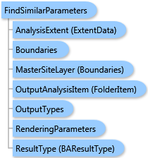
Syntax
Remarks
The analysis can be restricted to an analysis extent if the AnalysisExtent parameter is specified. The boundary layer sites are ranked based on similarity to a master site. If the MasterSiteLayer parameter is specified, the master site is selected from the master site layer. Otherwise, the master site is selected from the boundary layer. In both cases, the master site is selected by the OID value specified in the MasterSiteOID parameter.
The variables to rank sites by are collected from two sources: the CommonFields parameter specifies fields of the boundary layer and the Summarizations parameter specifies demographic variables. If the demographic variables are specified, the DataHierarchy parameter can specify a name of data hierarchy to summarize demographic variables by.
Two types of analysis are supported—the Conventional Analysis and the Principal Component Analysis.
For the Conventional Analysis, the PercentValues array specifies positive tolerance values in percents for ranking variables: at the beginning for the boundary layer fields and after that for the demographic variables. The Conventional Analysis is limited to 5 variables.
For the Principal Component Analysis, the PCARankSites parameter can specify the maximal number of sites with the best rank to be written to the output layer. If it is negative, all sites are ranked. The PCAEigenValue parameter specifies the eigenvalue boundary for Kaiser Criterion used in the Principal Component Analysis. The default value is 1 as recommended.
Output options for this task include rendering an output image (OutputTypes.GetMapImage) and/or creating a feature class for subsequent analysis (OutputTypes.GetFeatureClass). If no output options are specified, the required output options are specified as follows. If the RenderingParameters parameter is specified, the image output is requested. If the OutputAnalysisItem parameter is specified, the output analysis feature class will be stored in the repository. If both RenderingParameters and OutputAnalysisItem parameters are missing, the feature class output is requested.
Example
| C# |  Copy Code Copy Code |
|---|---|
FindSimilarParameters parameters = new FindSimilarParameters(); // The Boundaries type could take either data as // ESRI.ArcGIS.Client.Tasks.FeatureSet, ESRI.ArcGIS.Client.BAServer.FolderItem, // or ESRI.ArcGIS.Client.BACore.StandardLayer. // Set Boundaries with a valid data type. parameters.Boundaries = boundaries; // Set demographic variables to rank sites with. parameters.Summarizations = new List<string>() {"TOTPOP_CY", "HHPOP_CY"}; // Set ID of a geography layer to get demography data from. parameters.DataLayerID = "US.BlockGroups"; // Set OID of the master site to 1. parameters.MasterSiteOID = 1; // The Principal Component Analysis is the default analysis type. //parameters.AnalysisType = FindSimilarAnalysisType.esriFindSimilarAnalysisPCA; parameters.PCARankSites = 10; // Rank not more than 10 sites. parameters.PCAEigenvalue = 0.5; // The less value of this threshold, the more principal components are taken into account. // Optionally restrict analysis to ExtendData object specified with myExtent. //parameters.AnalysisExtent = myExtent; findSimilarTask.ExecuteAsync(parameters, new AsyncResponder(resultHandler, faultHandler)); | |
Inheritance Hierarchy
System.Object
ESRI.ArcGIS.Client.BACore.Client.BATaskParameters
ESRI.ArcGIS.Client.BACore.Client.AnalysisParameters
ESRI.ArcGIS.Client.BAServer.Tasks.AnalysisParameters
ESRI.ArcGIS.Client.BAServer.Tasks.Analyses.FindSimilarParameters
Requirements
Target Platforms: Windows 98, Windows NT 4.0, Windows Millennium Edition, Windows 2000, Windows XP Home Edition, Windows XP Professional, Windows Server 2003 family, Windows Vista, Windows Server 2008 family