


 Object Model
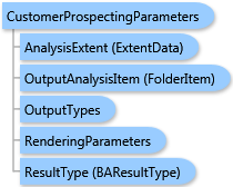
Syntax
Remarks
The AnalysisExtent parameter specifies the market area to prospect. The DataLayerID property specifies the geography layer for analysis.
Two types of prospecting analysis are supported—Conventional Analysis and Principal Component Analysis.
For Conventional Analysis, either the ProspectingQuery parameter or the CustomerProfileDescription parameter should be specified. In the first case, the WHERE-clause SQL statement is manually specified. It queries for sites from the geography layer with the given attribute values. In the last case, the floor and ceiling values for variables of the Customer Profile are used for generating the SQL query for the WHERE clause. Conditions for every variable of the profile are joined using the logical AND operation.
For Principal Component Analysis, the CustomerProfileDescription parameter should be specified. It defines the Customer Profile whose average values for profiled variables are used as a benchmark. The geography sites are ranked by similarity based on this benchmark. The PCARankSites parameter can specify the maximal number of sites to be ranked. If its value is -1 (default), all sites are ranked. The PCAEigenvalue parameter specifies the eigenvalue boundary for Kaiser Criterion used in Principal Component Analysis. The default value is 1 as recommended.
To prepare a Customer Profile for analysis, execute the Customer Profiling task and assign its result to the CustomerProfileDescription parameter value.
Output options for this task include rendering an output image (OutputTypes.GetMapImage) and/or creating a feature class for subsequent analysis (OutputTypes.GetFeatureClass). If no output options are specified, the required output options are specified as follows. If the RenderingParameters parameter is specified, the image output is requested. If the OutputAnalysisItem parameter is specified, the output analysis feature class will be stored in the repository. If both RenderingParameters and OutputAnalysisItem parameters are missing, the feature class output is requested.
Example
| C# |  Copy Code Copy Code |
|---|---|
CustomerProspectingParameters parameters = new CustomerProspectingParameters(); // Set ID of a geography layer to get demography for analysis from. parameters.DataLayerID = "US.BlockGroups"; // The Principal Component Analysis is the default analysis type. //parameters.ProspectingType = CustomerProspectingAnalysisType.esriCustomerProspectingPCA; parameters.PCARankSites = 10; // Rank not more than 10 sites. parameters.PCAEigenvalue = 0.5; // The less value of this threshold, the more principal components are taken into account. // Set the analysis extent to ExtendData object specified with myExtent. parameters.AnalysisExtent = myExtent; // The customerProfile string contains a customer profile returned by the Customer Profiling task. parameters.CustomerProfileDescription = customerProfile; customerProspectingTask.ExecuteAsync(parameters, new AsyncResponder(resultHandler, faultHandler)); | |
Inheritance Hierarchy
System.Object
ESRI.ArcGIS.Client.BACore.Client.BATaskParameters
ESRI.ArcGIS.Client.BACore.Client.AnalysisParameters
ESRI.ArcGIS.Client.BAServer.Tasks.AnalysisParameters
ESRI.ArcGIS.Client.BAServer.Tasks.Analyses.CustomerProspectingParameters
Requirements
Target Platforms: Windows 98, Windows NT 4.0, Windows Millennium Edition, Windows 2000, Windows XP Home Edition, Windows XP Professional, Windows Server 2003 family, Windows Vista, Windows Server 2008 family