Description
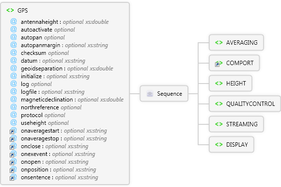
Used to specify GPS preferences and script subroutines to call when GPS events occur.
Diagram
Overview
 |
GPS
Used to specify GPS preferences and script subroutines to call when GPS events occur.
 |
antennaheight optional xs:double
|
|
autoactivate optional Restriction of xs:string
|
|
autopan optional Restriction of xs:string
|
|
autopanmargin optional xs:string
|
|
checksum optional Restriction of xs:string
|
|
datum optional xs:string
|
|
geoidseparation optional xs:double
|
|
initialize optional xs:string
|
|
log optional Restriction of xs:string
|
|
logfile optional xs:string
|
|
magneticdeclination optional xs:double
|
|
northreference optional Restriction of xs:string
|
|
protocol optional Restriction of xs:string
|
|
useheight optional Restriction of xs:string
|
 |
onaveragestart optional xs:string
Specify the script to run when this event occurs.
|
|
onaveragestop optional xs:string
Specify the script to run when this event occurs.
|
|
onclose optional xs:string
Specify the script to run when this event occurs
|
|
onexevent optional xs:string
Specify the script to run when this event occurs.
|
|
onopen optional xs:string
Specify the script to run when this event occurs
|
|
onposition optional xs:string
Specify the script to run when this event occurs.
|
|
onsentence optional xs:string
Specify the script to run when this event occurs.
|
 |
Sequence
|
AVERAGING
Used to specify the averaging settings for the GPS capture settings in ArcPadPrefs.apx.
|
enabled optional Restriction of xs:string
|
|
point optional xs:int
|
|
vertex optional xs:int
|
|
 |
COMPORT
Used to define serial port settings for the AUX or GPS port in ArcPadPrefs.apx.
|
|
HEIGHT
Used to specify height settings for the GPS in ArcPadPrefs.apx.
|
antennaheight optional xs:double
The antenna height specified in the GPS Height page of the GPS Preferences dialog in ArcPad, in meters. This value is subtracted from the height reported by the GPS receiver.
|
|
geiodseparation optional xs:double
The geoid separation specified in the GPS Height page of the GPS Preferences dialog in ArcPad, in meters. This value is subtracted from the height reported by the GPS receiver.
|
|
units optional xs:string
The units code that specifies height units for the geoid separation and antenna height in the GPS Height page of the GPS Preferences dialog in ArcPad.
|
|
usemapunits optional Restriction of xs:string
Specifies whether to use the units of the map's coordinate system when storing GPS elevation. If the coordinate system's units are degrees, the height units are meters.
|
|
|
QUALITYCONTROL
Used to define GPS quality control settings in ArcPadPrefs.apx.
|
level optional Restriction of xs:string
The level of quality control. 0 for no quality control; 1 for non-compulsory quality control; 2 for compulsory quality control.
|
|
Sequence
|
DAGE
Used to define the maximum DAGE for the GPS quality control settings in ArcPadPrefs.apx.
|
active optional Restriction of xs:string
|
|
maximum optional Restriction of xs:int
|
|
|
EPE
Used to define the maximum EPE for the GPS quality control settings in ArcPadPrefs.apx.
|
active optional Restriction of xs:string
|
|
maximum optional Restriction of xs:int
|
|
|
HDOP
Used to define the maximum HDOP for the GPS quality control settings in ArcPadPrefs.apx.
|
active optional Restriction of xs:string
|
|
maximum optional Restriction of xs:int
|
|
|
MODE
Used to specify the 3D only and DGPS only settings for the GPS quality control settings in ArcPadPrefs.apx.
|
threed optional Restriction of xs:string
Flag to determine if the 3D only setting is applied.
|
|
dgps optional Restriction of xs:string
Flag to determine if the DGPS only setting is applied.
|
|
pps optional Restriction of xs:string
Flag to determine if the PPS setting is applied.
|
|
rtkfixed optional Restriction of xs:string
Flag to determine if the RTK Fixed setting is applied.
|
|
rtkfloatorfixed optional Restriction of xs:string
Flag to determine if the RTK Float or Fixed setting is applied.
|
|
|
PDOP
Used to define the maximum PDOP for the GPS quality control settings in ArcPadPrefs.apx.
|
active optional Restriction of xs:string
|
|
maximum optional Restriction of xs:int
|
|
|
TDOP
Used to define the maximum TDOP for the GPS quality control settings in ArcPadPrefs.apx.
|
active optional Restriction of xs:string
|
|
maximum optional Restriction of xs:int
|
|
|
VDOP
Used to define the maximum VDOP for the GPS quality control settings in ArcPadPrefs.apx.
|
active optional Restriction of xs:string
|
|
maximum optional Restriction of xs:int
|
|
|
VPE
Used to define the maximum VPE for the GPS quality control settings in ArcPadPrefs.apx.
|
active optional Restriction of xs:string
|
|
maximum optional Restriction of xs:int
|
|
|
|
|
STREAMING
Used to specify the streaming interval settings for the GPS capture settings in ArcPadPrefs.apx.
|
distanceinterval optional xs:double
Minimum distance interval of GPS fixes to capture at for streaming polyline/polygon features (in meters).
|
|
interval optional xs:int
Interval of GPS fixes to capture at for streaming polyline/polygon features (in seconds).
|
|
|
|
Attributes
| Name | Type | Use | Default | Fixed | Description |
|---|
| antennaheight | xs:double | optional | 0.0 | | |
| autoactivate | Restriction of xs:string | optional | false | | |
| autopan | Restriction of xs:string | optional | false | | |
| autopanmargin | xs:string | optional | | | |
| checksum | Restriction of xs:string | optional | false | | |
| datum | xs:string | optional | | | |
| geoidseparation | xs:double | optional | 0.0 | | |
| initialize | xs:string | optional | | | |
| log | Restriction of xs:string | optional | 0 | | |
| logfile | xs:string | optional | | | |
| magneticdeclination | xs:double | optional | 0.0 | | |
| northreference | Restriction of xs:string | optional | magnetic | | |
| protocol | Restriction of xs:string | optional | | | |
| useheight | Restriction of xs:string | optional | | | |
| onaveragestart | xs:string | optional | | | Specify the script to run when this event occurs. |
| onaveragestop | xs:string | optional | | | Specify the script to run when this event occurs. |
| onclose | xs:string | optional | | | Specify the script to run when this event occurs |
| onexevent | xs:string | optional | | | Specify the script to run when this event occurs. |
| onopen | xs:string | optional | | | Specify the script to run when this event occurs |
| onposition | xs:string | optional | | | Specify the script to run when this event occurs. |
| onsentence | xs:string | optional | | | Specify the script to run when this event occurs. |
Remarks
Examples
Source
<xs:element name="GPS" xmlns:xs="http://www.w3.org/2001/XMLSchema">
  <xs:annotation>
    <xs:documentation>Used to specify GPS preferences and script subroutines to call when GPS events occur.</xs:documentation>
  </xs:annotation>
  <xs:complexType>
    <xs:sequence>
      <xs:element name="AVERAGING">
        <xs:complexType>
          <xs:attribute default="false" name="enabled">
            <xs:simpleType>
              <xs:restriction base="xs:string">
                <xs:enumeration value="true" />
                <xs:enumeration value="false" />
              </xs:restriction>
            </xs:simpleType>
          </xs:attribute>
          <xs:attribute name="point" type="xs:int" />
          <xs:attribute name="vertex" type="xs:int" />
        </xs:complexType>
      </xs:element>
      <xs:element ref="COMPORT" />
      <xs:element name="HEIGHT">
        <xs:annotation>
          <xs:documentation>Used to specify height settings for the GPS in ArcPadPrefs.apx.</xs:documentation>
        </xs:annotation>
        <xs:complexType>
          <xs:attribute default="0.0" name="antennaheight" type="xs:double">
            <xs:annotation>
              <xs:documentation>The antenna height specified in the GPS Height page of the GPS Preferences dialog in ArcPad, in meters. This value is subtracted from the height reported by the GPS receiver.</xs:documentation>
            </xs:annotation>
          </xs:attribute>
          <xs:attribute default="0.0" name="geiodseparation" type="xs:double">
            <xs:annotation>
              <xs:documentation>The geoid separation specified in the GPS Height page of the GPS Preferences dialog in ArcPad, in meters. This value is subtracted from the height reported by the GPS receiver.</xs:documentation>
            </xs:annotation>
          </xs:attribute>
          <xs:attribute name="units" type="xs:string">
            <xs:annotation>
              <xs:documentation>The units code that specifies height units for the geoid separation and antenna height in the GPS Height page of the GPS Preferences dialog in ArcPad.</xs:documentation>
            </xs:annotation>
          </xs:attribute>
          <xs:attribute default="true" name="usemapunits">
            <xs:annotation>
              <xs:documentation>Specifies whether to use the units of the map's coordinate system when storing GPS elevation. If the coordinate system's units are degrees, the height units are meters.</xs:documentation>
            </xs:annotation>
            <xs:simpleType>
              <xs:restriction base="xs:string">
                <xs:enumeration value="true" />
                <xs:enumeration value="false" />
              </xs:restriction>
            </xs:simpleType>
          </xs:attribute>
        </xs:complexType>
      </xs:element>
      <xs:element name="QUALITYCONTROL">
        <xs:annotation>
          <xs:documentation>Used to define GPS quality control settings in ArcPadPrefs.apx.</xs:documentation>
        </xs:annotation>
        <xs:complexType>
          <xs:sequence>
            <xs:element name="DAGE">
              <xs:annotation>
                <xs:documentation>Used to define the maximum DAGE for the GPS quality control settings in ArcPadPrefs.apx.</xs:documentation>
              </xs:annotation>
              <xs:complexType>
                <xs:attribute default="false" ref="active">
                  <xs:annotation>
                    <xs:documentation>Flag to determine if the maximum DAGE setting is applied.</xs:documentation>
                  </xs:annotation>
                </xs:attribute>
                <xs:attribute ref="maximum">
                  <xs:annotation>
                    <xs:documentation>The maximum DAGE allowed.</xs:documentation>
                  </xs:annotation>
                </xs:attribute>
              </xs:complexType>
            </xs:element>
            <xs:element name="EPE">
              <xs:annotation>
                <xs:documentation>Used to define the maximum EPE for the GPS quality control settings in ArcPadPrefs.apx.</xs:documentation>
              </xs:annotation>
              <xs:complexType>
                <xs:attribute default="false" ref="active">
                  <xs:annotation>
                    <xs:documentation>Flag to determine if the maximum EPE setting is applied.</xs:documentation>
                  </xs:annotation>
                </xs:attribute>
                <xs:attribute ref="maximum">
                  <xs:annotation>
                    <xs:documentation>The maximum EPE allowed.</xs:documentation>
                  </xs:annotation>
                </xs:attribute>
              </xs:complexType>
            </xs:element>
            <xs:element name="HDOP">
              <xs:annotation>
                <xs:documentation>Used to define the maximum HDOP for the GPS quality control settings in ArcPadPrefs.apx.</xs:documentation>
              </xs:annotation>
              <xs:complexType>
                <xs:attribute default="false" ref="active">
                  <xs:annotation>
                    <xs:documentation>Flag to determine if the maximum HDOP setting is applied.</xs:documentation>
                  </xs:annotation>
                </xs:attribute>
                <xs:attribute ref="maximum">
                  <xs:annotation>
                    <xs:documentation>The maximum HDOP allowed.</xs:documentation>
                  </xs:annotation>
                </xs:attribute>
              </xs:complexType>
            </xs:element>
            <xs:element name="MODE">
              <xs:annotation>
                <xs:documentation>Used to specify the 3D only and DGPS only settings for the GPS quality control settings in ArcPadPrefs.apx.</xs:documentation>
              </xs:annotation>
              <xs:complexType>
                <xs:attribute default="false" name="threed">
                  <xs:annotation>
                    <xs:documentation>Flag to determine if the 3D only setting is applied.</xs:documentation>
                  </xs:annotation>
                  <xs:simpleType>
                    <xs:restriction base="xs:string">
                      <xs:enumeration value="true" />
                      <xs:enumeration value="false" />
                    </xs:restriction>
                  </xs:simpleType>
                </xs:attribute>
                <xs:attribute default="false" name="dgps">
                  <xs:annotation>
                    <xs:documentation>Flag to determine if the DGPS only setting is applied.</xs:documentation>
                  </xs:annotation>
                  <xs:simpleType>
                    <xs:restriction base="xs:string">
                      <xs:enumeration value="true" />
                      <xs:enumeration value="false" />
                    </xs:restriction>
                  </xs:simpleType>
                </xs:attribute>
                <xs:attribute default="false" name="pps">
                  <xs:annotation>
                    <xs:documentation>Flag to determine if the PPS setting is applied.</xs:documentation>
                  </xs:annotation>
                  <xs:simpleType>
                    <xs:restriction base="xs:string">
                      <xs:enumeration value="true" />
                      <xs:enumeration value="false" />
                    </xs:restriction>
                  </xs:simpleType>
                </xs:attribute>
                <xs:attribute default="false" name="rtkfixed">
                  <xs:annotation>
                    <xs:documentation>Flag to determine if the RTK Fixed setting is applied.</xs:documentation>
                  </xs:annotation>
                  <xs:simpleType>
                    <xs:restriction base="xs:string">
                      <xs:enumeration value="true" />
                      <xs:enumeration value="false" />
                    </xs:restriction>
                  </xs:simpleType>
                </xs:attribute>
                <xs:attribute default="false" name="rtkfloatorfixed">
                  <xs:annotation>
                    <xs:documentation>Flag to determine if the RTK Float or Fixed setting is applied.</xs:documentation>
                  </xs:annotation>
                  <xs:simpleType>
                    <xs:restriction base="xs:string">
                      <xs:enumeration value="true" />
                      <xs:enumeration value="false" />
                    </xs:restriction>
                  </xs:simpleType>
                </xs:attribute>
              </xs:complexType>
            </xs:element>
            <xs:element name="PDOP">
              <xs:annotation>
                <xs:documentation>Used to define the maximum PDOP for the GPS quality control settings in ArcPadPrefs.apx.</xs:documentation>
              </xs:annotation>
              <xs:complexType>
                <xs:attribute default="false" ref="active">
                  <xs:annotation>
                    <xs:documentation>Flag to determine if the maximum PDOP setting is applied.</xs:documentation>
                  </xs:annotation>
                </xs:attribute>
                <xs:attribute ref="maximum">
                  <xs:annotation>
                    <xs:documentation>The maximum PDOP allowed.</xs:documentation>
                  </xs:annotation>
                </xs:attribute>
              </xs:complexType>
            </xs:element>
            <xs:element name="TDOP">
              <xs:annotation>
                <xs:documentation>Used to define the maximum TDOP for the GPS quality control settings in ArcPadPrefs.apx.</xs:documentation>
              </xs:annotation>
              <xs:complexType>
                <xs:attribute default="false" ref="active">
                  <xs:annotation>
                    <xs:documentation>Flag to determine if the maximum TDOP setting is applied.</xs:documentation>
                  </xs:annotation>
                </xs:attribute>
                <xs:attribute ref="maximum">
                  <xs:annotation>
                    <xs:documentation>The maximum TDOP allowed.</xs:documentation>
                  </xs:annotation>
                </xs:attribute>
              </xs:complexType>
            </xs:element>
            <xs:element name="VDOP">
              <xs:annotation>
                <xs:documentation>Used to define the maximum VDOP for the GPS quality control settings in ArcPadPrefs.apx.</xs:documentation>
              </xs:annotation>
              <xs:complexType>
                <xs:attribute default="false" ref="active">
                  <xs:annotation>
                    <xs:documentation>Flag to determine if the maximum VDOP setting is applied.</xs:documentation>
                  </xs:annotation>
                </xs:attribute>
                <xs:attribute ref="maximum">
                  <xs:annotation>
                    <xs:documentation>The maximum VDOP allowed.</xs:documentation>
                  </xs:annotation>
                </xs:attribute>
              </xs:complexType>
            </xs:element>
            <xs:element name="VPE">
              <xs:annotation>
                <xs:documentation>Used to define the maximum VPE for the GPS quality control settings in ArcPadPrefs.apx.</xs:documentation>
              </xs:annotation>
              <xs:complexType>
                <xs:attribute default="false" ref="active">
                  <xs:annotation>
                    <xs:documentation>Flag to determine if the maximum VPE setting is applied.</xs:documentation>
                  </xs:annotation>
                </xs:attribute>
                <xs:attribute ref="maximum">
                  <xs:annotation>
                    <xs:documentation>The maximum VPE allowed.</xs:documentation>
                  </xs:annotation>
                </xs:attribute>
              </xs:complexType>
            </xs:element>
          </xs:sequence>
          <xs:attribute default="0" name="level">
            <xs:annotation>
              <xs:documentation>The level of quality control. 0 for no quality control; 1 for non-compulsory quality control; 2 for compulsory quality control.</xs:documentation>
            </xs:annotation>
            <xs:simpleType>
              <xs:restriction base="xs:string">
                <xs:enumeration value="0" />
                <xs:enumeration value="1" />
                <xs:enumeration value="2" />
              </xs:restriction>
            </xs:simpleType>
          </xs:attribute>
        </xs:complexType>
      </xs:element>
      <xs:element name="STREAMING">
        <xs:annotation>
          <xs:documentation>Used to specify the streaming interval settings for the GPS capture settings in ArcPadPrefs.apx.</xs:documentation>
        </xs:annotation>
        <xs:complexType>
          <xs:attribute default="0.0" name="distanceinterval" type="xs:double">
            <xs:annotation>
              <xs:documentation>Minimum distance interval of GPS fixes to capture at for streaming polyline/polygon features (in meters).</xs:documentation>
            </xs:annotation>
          </xs:attribute>
          <xs:attribute default="1" name="interval" type="xs:int">
            <xs:annotation>
              <xs:documentation>Interval of GPS fixes to capture at for streaming polyline/polygon features (in seconds).</xs:documentation>
            </xs:annotation>
          </xs:attribute>
        </xs:complexType>
      </xs:element>
      <xs:element name="DISPLAY" />
    </xs:sequence>
    <xs:attribute default="0.0" name="antennaheight" type="xs:double" />
    <xs:attribute default="false" name="autoactivate">
      <xs:simpleType>
        <xs:restriction base="xs:string">
          <xs:enumeration value="true" />
          <xs:enumeration value="false" />
        </xs:restriction>
      </xs:simpleType>
    </xs:attribute>
    <xs:attribute default="false" name="autopan">
      <xs:simpleType>
        <xs:restriction base="xs:string">
          <xs:enumeration value="true" />
          <xs:enumeration value="false" />
        </xs:restriction>
      </xs:simpleType>
    </xs:attribute>
    <xs:attribute name="autopanmargin" type="xs:string" />
    <xs:attribute default="false" name="checksum">
      <xs:simpleType>
        <xs:restriction base="xs:string">
          <xs:enumeration value="true" />
          <xs:enumeration value="false" />
        </xs:restriction>
      </xs:simpleType>
    </xs:attribute>
    <xs:attribute name="datum" type="xs:string" />
    <xs:attribute default="0.0" name="geoidseparation" type="xs:double" />
    <xs:attribute name="initialize" type="xs:string" />
    <xs:attribute default="0" name="log">
      <xs:simpleType>
        <xs:restriction base="xs:string">
          <xs:enumeration value="0" />
          <xs:enumeration value="1" />
          <xs:enumeration value="2" />
        </xs:restriction>
      </xs:simpleType>
    </xs:attribute>
    <xs:attribute name="logfile" type="xs:string" />
    <xs:attribute default="0.0" name="magneticdeclination" type="xs:double" />
    <xs:attribute default="magnetic" name="northreference">
      <xs:simpleType>
        <xs:restriction base="xs:string">
          <xs:enumeration value="magnetic" />
          <xs:enumeration value="true" />
        </xs:restriction>
      </xs:simpleType>
    </xs:attribute>
    <xs:attribute name="protocol">
      <xs:simpleType>
        <xs:restriction base="xs:string">
          <xs:enumeration value="NMEA" />
          <xs:enumeration value="TSIP" />
          <xs:enumeration value="EART" />
          <xs:enumeration value="PLGR" />
        </xs:restriction>
      </xs:simpleType>
    </xs:attribute>
    <xs:attribute name="useheight">
      <xs:simpleType>
        <xs:restriction base="xs:string">
          <xs:enumeration value="true" />
          <xs:enumeration value="false" />
        </xs:restriction>
      </xs:simpleType>
    </xs:attribute>
    <xs:attribute ref="onaveragestart" />
    <xs:attribute ref="onaveragestop" />
    <xs:attribute ref="onclose" />
    <xs:attribute ref="onexevent" />
    <xs:attribute ref="onopen" />
    <xs:attribute ref="onposition" />
    <xs:attribute ref="onsentence" />
  </xs:complexType>
</xs:element> |
See Also