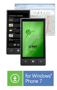
ArcGIS provides a great way to discover and use maps on your Windows Phone. Using the ArcGIS application you can:
- Use maps authored in ArcGIS.com
- Navigate map galleries
- Access your own GIS data
- Display and zoom to current location
- Perform linear and area measurements
- Retrieve detailed map metadata
- View feature attribute information
- Perform keyword search and get access to relevant information
- Change the visibility of layers
- Access popular maps faster by adding them to your favorites list
- Use your GPS or tap on the map to collect and update GIS data
- Attach photos to what you collect
- Supports pre-defined queries
ArcGIS is now available in the Windows Phone Marketplace!
Download and install ArcGIS using Zune on your desktop or install from the Marketplace on your Windows Phone.
If you have inquires regarding the application, please email arcgis4windowsphone@esri.com.
The following enhancements and fixes are included in the 1.1 release:
- Added support for pre-defined queries.
- Identify and return addresses outside the United States.
- Search textbox now allows more than 45 characters.
- Measure unit settings now preserved when the web map is changed.
- Pan of the map enabled during edit of point features.
- Made polyline features easier to select for editing.
- Display subtypes of a field when editing.
- Show a loading indicator for attachments.
- Cached map information no longer crashes the application if the service availability has changed.
- Properly handle unexpected Mobile Content.
- Fix crash on load of a webmap with a secure service.
- Fix issue of identifing during pan of the map.
- Reprojecting geometry between geographic and web mercator is now done on the client.
- Don't load old maps when backing through the application.
- Provide a message if "locate me" used when location services turned off on the device.