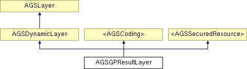
AGSGPResultLayer Class Reference
Description
This dynamic layer is returned as a result of calling queryResultImageLayer from an asynchronous geoprocessing task that is associated with a result map service.
- Defined in:
- AGSGPResultLayer.h ( ArcGIS library)
- Since:
- 1.0
Public Member Functions | |
| (void) | - dataChanged |
| (void) | - decodeWithJSON: |
| (NSDictionary *) | - encodeToJSON |
| (NSOperation < AGSDynamicLayerDrawingOperation > *) | - exportMapImage: |
| (id) | - initWithJSON: |
| (id) | - initWithURL: |
| (id) | - initWithURL:credential: |
| (void) | - layerDidFailToLoad: |
| (void) | - layerDidLoad |
Properties | |
| AGSCredential * | credential |
| id< AGSLayerDelegate > | delegate |
| NSUInteger | dpi |
| NSError * | error |
| id< AGSExportMapImageDelegate > | exportDelegate |
| AGSEnvelope * | fullEnvelope |
| AGSDynamicLayerGPSAutoPanDrawingMode | gpsAutoPanDrawingMode |
| AGSImageFormat | imageFormat |
| AGSEnvelope * | initialEnvelope |
| BOOL | loaded |
| double | maxScale |
| double | minScale |
| NSString * | name |
| BOOL | renderNativeResolution |
| AGSSpatialReference * | spatialReference |
| BOOL | timeAware |
| BOOL | transparent |
| AGSUnits | units |
| NSURL * | URL |
Member Function Documentation
| - (void) dataChanged |
This method tells the layer that the data has changed and it should be redrawn.
- Since:
- 1.0
Implemented in AGSGraphicsLayer.
| - (void) decodeWithJSON: | (NSDictionary *) | json | [optional, inherited] |
Decode object from JSON representation.
- Parameters:
-
json The JSON representation of the object to be decoded.
- Since:
- 1.0
| - (NSDictionary *) encodeToJSON | [optional, inherited] |
Encode and return JSON representation for object.
- Returns:
- JSON representation of object.
- Since:
- 1.0
| - (NSOperation<AGSDynamicLayerDrawingOperation>*) exportMapImage: | (AGSExportImageParams *) | params |
Get new map image. The exportDelegate is notified when the image is exported. This method must be implemented by subclasses.
- Parameters:
-
params The input parameters for the export image operation.
- Since:
- 1.0
| - (id) initWithJSON: | (NSDictionary *) | json | [optional, inherited] |
Initialize and return object from JSON representation.
- Parameters:
-
json The JSON representation of the object to be created.
- Returns:
- Object decoded from JSON representation.
- Since:
- 1.0
| - (id) initWithURL: | (NSURL *) | url |
Initialize this layer with a URL of a AGSGPResultLayer
- Parameters:
-
url to dynamic map service.
- Returns:
- A new
AGSGPResultLayerobject.
- Since:
- 1.0
| - (id) initWithURL: | (NSURL *) | url | ||
| credential: | (AGSCredential *) | cred | ||
Initialize this layer with a URL of a AGSGPResultLayer
- Parameters:
-
url to dynamic map service. cred AGSCredentialto use to access secured resource.
- Returns:
- A new
AGSGPResultLayerobject.
- Since:
- 1.0
| - (void) layerDidFailToLoad: | (NSError *) | error |
Method to notify the delegate that a layer failed to load. This method will also post a "LayerFailedToLoad" notification that can be observed by the developer.
- Parameters:
-
error Information regarding the cause of the layer failing to load.
- Since:
- 1.0
| - (void) layerDidLoad |
Method to notify the delegate that a layer successfully loaded. This method will also post a "LayerDidLoad" notification that can be observed by the developer.
- Since:
- 1.0
Property Documentation
- (AGSCredential*) credential [read, copy] |
The credential to be used to access secured resources.
- Since:
- 1.0
Reimplemented from <AGSSecuredResource>.
- (id<AGSLayerDelegate>) delegate [read, write, assign, inherited] |
Delegate to be notified when the layer is loaded or fails to load. When this layer is loaded, a corresponding AGSLayerView object is automatically set as the delegate. This delegate must not be replaced.
- Since:
- 1.0
- (NSUInteger) dpi [read, write, assign] |
The DPI (dots-per-inch) resolution of map images generated by this layer's map service. The dpi will default to a value that takes into account the dpi of the device and the value of the renderNativeResolution property. If you programmatically change the dpi, it will then cease to change when the renderNativeResolution property changes.
- Since:
- 1.0
- (NSError*) error [read, retain, inherited] |
Information about the error associated with a layer.
- Since:
- 1.0
- (id<AGSExportMapImageDelegate>) exportDelegate [read, write, assign, inherited] |
Delegate to be notified of events related to exporting the map image. When this layer is loaded, a corresponding View object is automatically set as the exportDelegate which should not be replaced.
- Since:
- 1.0
- (AGSEnvelope*) fullEnvelope [read, retain] |
- (AGSDynamicLayerGPSAutoPanDrawingMode) gpsAutoPanDrawingMode [read, write, assign, inherited] |
Defines the drawing behavior for a dynamic layer when the map's gps is in an auto-pan mode. For some layers, especially those that make network request, you may want this property accordingly. When the map is navigating from the gps it can generate a lot of requests resulting in a heavy server load.
- Since:
- 2.1
- (AGSImageFormat) imageFormat [read, write, assign] |
The image format of the map. Possible values include
AGSImageFormatPNG32AGSImageFormatPNG24AGSImageFormatPNG8AGSImageFormatPNGAGSImageFormatJPGAGSImageFormatGIF
Please consult the ArcGIS Server REST Services Directory to ensure the map service supports the requested image format.
- Since:
- 1.0
- (AGSEnvelope*) initialEnvelope [read, retain] |
- (BOOL) loaded [read, assign, inherited] |
A property indicating whether the layer is loaded and ready to be used. When the layer is loaded, the value becomes YES, and layer properties can be accessed.
- Since:
- 1.0
- See also:
- AGSLayerDelegate
- (double) maxScale [read, assign, inherited] |
- (double) minScale [read, assign, inherited] |
- (NSString*) name [read, retain, inherited] |
The name of the layer. This property will be set by the framework when the layer is added to the map.
- Since:
- 1.8
- (BOOL) renderNativeResolution [read, write, assign] |
Flag indicating if the layer renders at the native resolution. This property will not have any affect iOS devices without a retina display. If using an iOS device with a retina display and you want to take advantage of that display you can set this value to YES. The property must be set before the layer loads.
When rendering at the native resolution, this layer will use more network bandwidth and memory (because the map images will be bigger).
- Since:
- 2.1
Implements AGSLayer.
- (AGSSpatialReference*) spatialReference [read, retain] |
- (BOOL) timeAware [read, assign, inherited] |
A property indicating whether the layer is time-aware.
- Since:
- 1.0
- (BOOL) transparent [read, write, assign] |
A property indicating whether or not images generated by the map service should be transparent.
- Since:
- 1.0
- (AGSUnits) units [read, write, assign, inherited] |
The units the layer is in. Possible values include
AGSUnitsCentimetersAGSUnitsDecimalDegreesAGSUnitsDecimetersAGSUnitsFeetAGSUnitsInchesAGSUnitsKilometersAGSUnitsMetersAGSUnitsMilesAGSUnitsMillimetersAGSUnitsNauticalMilesAGSUnitsPointsAGSUnitsUnknownAGSUnitsYards
- Since:
- 1.0
- (NSURL*) URL [read, copy] |
URL of the AGSGPResultLayer resource in the ArcGIS Server REST Services Directory.
- Since:
- 1.0